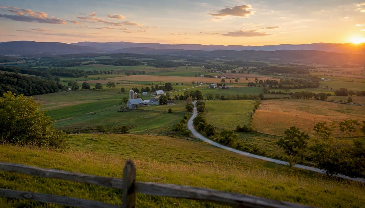
Augusta County is the Shenandoah Valley's most versatile basecamp, a rural Virginia county where the Blue Ridge and Allegheny mountains frame a valley floor packed with working farms, show caves, trout streams, and two historic independent cities. The 2020 census recorded a population of 77,487, the county seat sits at Verona, and its largest community is Stuarts Draft. Visit Augusta County positions the region as a launchpad for Shenandoah National Park, Grand Caverns, Natural Chimneys, and Mossy Creek fly fishing, while the Board of Supervisors manages a county government that serves residents across nearly 1,000 square miles of some of Virginia's most productive agricultural land.
Three things to know right away:
- Augusta County surrounds but does not govern the independent cities of Staunton and Waynesboro, a legal quirk that shapes everything from school enrollment to tax bills.
- Grand Caverns is the oldest continually operating show cave in the United States, and it sits right in the county.
- The I‑81/I‑64 interchange makes the county a genuine crossroads, not just a scenic detour.
| Quick Fact | Detail |
|---|---|
| County seat | Verona |
| Largest community | Stuarts Draft |
| Total area | ~971 sq mi |
| 2020 census population | 77,487 |
| Time zone | Eastern (ET) |
| Official website | co.augusta.va.us |
Key Takeaways
Augusta County is a Shenandoah Valley county of 77,487 residents that combines genuine outdoor recreation access, a working agricultural economy, and affordable housing into one of Virginia's most livable rural settings.
| Point | Details |
|---|---|
| Location and access | Augusta County sits at the I‑81/I‑64 junction in Virginia's Shenandoah Valley, within 45 minutes of Charlottesville and 2.5 hours of D.C. |
| Top attractions | Grand Caverns, Natural Chimneys, Mossy Creek fly fishing, and Shenandoah National Park access define the outdoor recreation offer. |
| Government structure | A seven-member Board of Supervisors governs the county from Verona; Staunton and Waynesboro are independent cities within county borders. |
| Economy and agriculture | The county has a significant number of farms, supporting agriculture and local food businesses. and an I‑64/I‑81 logistics advantage supports manufacturing, agritourism, and distribution businesses. |
| Beamsrealtygroup | Buyers and sellers in Augusta County get local market analysis and transaction support from Beamsrealtygroup at beamsrealtygroup.com. |
Table of Contents
- What are the key facts about Augusta County?
- Augusta County history: from 1738 to today
- What natural areas and parks does Augusta County offer?
- How is Augusta County governed?
- What do Augusta County's demographics look like?
- What drives Augusta County's economy?
- What schools serve Augusta County families?
- What are the best things to do in Augusta County?
- Where do people live in Augusta County?
- How do you get to and around Augusta County?
- What is it like to live in Augusta County?
- Why Augusta County works as a place to live and do business
- What residents say about living here
- Buying or selling property in Augusta County
- Sources
What are the key facts about Augusta County?
Augusta County covers roughly 971 square miles of land and water in Virginia's Shenandoah Valley, bordered by the Blue Ridge Mountains to the east and the Alleghenies to the west. Its county seat is Verona, where the Augusta County Government Center handles day-to-day administration and public meetings. Stuarts Draft, an unincorporated community in the southeastern part of the county, is the most populous single community within county jurisdiction.
One geographic fact that surprises newcomers: Staunton and Waynesboro sit entirely inside Augusta County's borders but are legally independent cities under Virginia law. They have their own governments, school systems, and tax structures. The county does not govern them, even though a map makes them look like county territory.
- Official county site: Co
- Tourism: Visitaugustacounty
- Time zone: Eastern Time (UTC−5 standard, UTC−4 daylight)
- Adjacent counties: Rockingham, Highland, Bath, Rockbridge, Nelson, Albemarle, Waynesboro (city), Staunton (city)
Augusta County history: from 1738 to today
The county was formed in 1738 from Orange County and named for Princess Augusta of Saxe-Gotha, mother of King George III. At formation, it was one of the largest counties in British North America, eventually giving rise to Kentucky, Ohio, Indiana, Illinois, Michigan, Wisconsin, and West Virginia, among other territories. That origin story makes Augusta County one of the most consequential pieces of colonial-era Virginia geography.
Staunton served as the county seat for most of its history before the government center relocated to Verona. The city of Waynesboro was incorporated separately over time, and both cities eventually achieved independent status under Virginia's unusual city-county separation system.
Historic timeline highlights:
- 1738: County formed from Orange County; named for Princess Augusta of Saxe-Gotha
- 1778 onward: Boundary reductions as western territories were carved into new states and counties
- 1864: Battle of Piedmont fought near New Hope; one of the Civil War's more decisive Valley engagements
- Late 19th century: Staunton and Waynesboro develop as independent railroad and manufacturing centers
- 20th century: Both cities achieve full independent-city status under Virginia law
Historic sites worth visiting include Grand Caverns (explored since 1804), the Blue Ridge Tunnel (a pre-Civil War engineering feat near Waynesboro), and the Frontier Culture Museum in Staunton, which sits just outside county jurisdiction but draws visitors to the broader region.
What natural areas and parks does Augusta County offer?
The county's geography is defined by its valley position between two mountain ranges. The Shenandoah River's South Fork and the Middle River drain much of the valley floor, while the Blue Ridge forms the eastern wall and the Alleghenies rise to the west. That terrain creates a layered outdoor recreation zone that few Virginia counties can match.
Major protected areas and natural attractions:
- Shenandoah National Park (southern entrance via Rockfish Gap): federal park with Skyline Drive, Appalachian Trail access, and waterfalls
- Blue Ridge Parkway (northern entrance near Waynesboro): 469-mile scenic road managed by the National Park Service
- George Washington and Jefferson National Forests: hundreds of thousands of acres of federal forest land on both mountain flanks
- Grand Caverns (Grottoes): the oldest continually operating show cave in the United States, open for guided tours
- Natural Chimneys Regional Park (Mount Solon): seven limestone towers rising up to 120 feet, managed by the county
- Mossy Creek: a spring-fed limestone stream in the valley, nationally recognized for wild brown trout fly fishing
Statistic callout: Natural Chimneys Park offers free day-use access year-round, though the campground operates seasonally and certain events are privately ticketed, meaning access can be restricted on specific dates.
The county manages Natural Chimneys directly; Shenandoah National Park and the Blue Ridge Parkway are federal. George Washington and Jefferson National Forests are managed by the U.S. Forest Service. Grand Caverns operates as a county-affiliated attraction. Knowing which agency manages which area matters when you're planning permits, camping reservations, or event access.
Spring and fall are the most popular seasons. Summer brings full campground capacity and peak cave-tour demand. Winter access to higher elevations can be limited by weather, but valley-floor attractions like Grand Caverns stay open year-round.
How is Augusta County governed?
Augusta County is administered by a seven-member Board of Supervisors, each elected from one of the county's magisterial districts for four-year staggered terms. A County Administrator handles day-to-day operations and reports to the board. This structure is standard for Virginia counties and keeps elected oversight close to local communities.
The Augusta County Government Center in Verona is the hub for public meetings, planning and zoning hearings, and most administrative services. Board meetings follow a published schedule, and agendas are posted on the official county website ahead of each session. Public comment periods are part of the routine meeting structure.
Key civic services available through the county:
- Property assessment and tax records
- Building permits and land-use planning
- Parks and recreation programming
- Emergency management and public safety coordination
- Voter registration and elections administration
The county's seven magisterial districts each elect one supervisor, so representation is geographically distributed across the rural and suburban parts of the county. Contact information for each supervisor is listed on the government website.
What do Augusta County's demographics look like?
The 2020 U.S. Census counted 77,487 residents in Augusta County. Population density is low given the county's size, reflecting its rural character. The county has grown modestly over recent decades, with Stuarts Draft and the areas near Verona seeing the most residential development.
| Demographic indicator | Data |
|---|---|
| 2020 census population | 77,487 |
| County area | ~971 sq mi |
| County seat | Verona |
| Largest community | Stuarts Draft |
| Independent cities within borders | Staunton, Waynesboro |
Notable demographic patterns:
- The population skews slightly older than the Virginia state average, consistent with rural counties that attract retirees and long-term residents.
- Household types lean toward owner-occupied single-family homes, with a lower share of rental housing than urban Virginia markets.
- Growth is concentrated in the southeastern corridor near Stuarts Draft and along the I‑81 corridor, where commercial and residential development has been most active.
- The county's population does not include Staunton or Waynesboro residents, who are counted separately in census data for those independent cities.
What drives Augusta County's economy?
Manufacturing, agriculture, logistics, and tourism form the county's economic backbone. The intersection of I‑64 and I‑81 is the single biggest structural advantage: it puts Augusta County within a day's drive of roughly a third of the U.S. population, which is why distribution and light manufacturing operations find it attractive.
Agriculture remains a defining feature. The county has a significant number of farms, supporting agriculture and local food businesses. operate in the county, producing beef cattle, poultry, grain, and dairy products. That farm density supports a growing agritourism and local-food sector, with farm stands, pick-your-own operations, and farm-to-table restaurants drawing visitors who might otherwise skip the Valley entirely.
Major economic sectors:
- Manufacturing: food processing, wood products, and light industrial operations along the I‑81 corridor
- Agriculture: cattle, poultry, grain, and dairy; agritourism growing alongside traditional farming
- Logistics and distribution: I‑64/I‑81 junction drives warehouse and distribution investment
- Tourism: outdoor recreation, Grand Caverns, Natural Chimneys, and Shenandoah Valley heritage tourism
- Healthcare and services: regional employment anchored partly by facilities in adjacent Staunton and Waynesboro
Many county residents commute to Staunton, Waynesboro, or Harrisonburg for employment in healthcare, education, and retail. The regional economy functions as an integrated unit even though the jurisdictions are legally separate.
What schools serve Augusta County families?
Augusta County Public Schools is the primary K–12 division serving county residents. It operates elementary, middle, and high schools across the county's communities, including schools in Stuarts Draft, Verona, Churchville, and Fort Defiance. School enrollment and performance data are available through the division's website and the Virginia Department of Education.
Staunton City Schools and Waynesboro City Schools serve residents of those independent cities separately. Families moving to the county need to confirm which school division covers their specific address, since the city-county boundary affects enrollment.
Nearby higher education options:
- Mary Baldwin University (Staunton): liberal arts university with graduate programs
- Blue Ridge Community College (Weyers Cave): two-year college serving Augusta County and neighboring Rockingham County; strong workforce development and transfer programs
- James Madison University (Harrisonburg, ~30 miles north): large regional university with a broad range of undergraduate and graduate programs
- University of Virginia (Charlottesville, ~40 miles east): accessible via I‑64
Blue Ridge Community College is the most directly relevant institution for county residents seeking workforce credentials, associate degrees, or transfer pathways without relocating.
What are the best things to do in Augusta County?
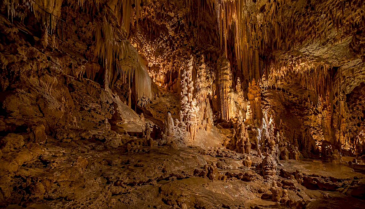
Grand Caverns in Grottoes is the place to start. As the oldest continually operating show cave in the United States, it has been welcoming visitors since 1804, and the guided tours through its cathedral-sized rooms still hold up. Natural Chimneys in Mount Solon offers a completely different experience: seven limestone towers rising from the valley floor, free to walk around on any day of the year.
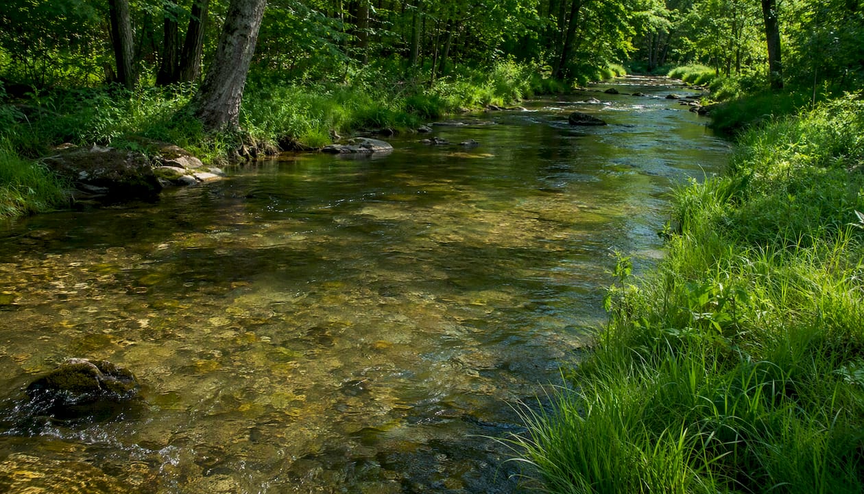
Mossy Creek is a spring-fed limestone stream that fly fishers travel from across the mid-Atlantic to fish. The wild brown trout population and the creek's consistent temperature make it one of Virginia's best cold-water fisheries. Access requires a Virginia fishing license, and sections of the creek run through private land, so checking current access points before you go is worth the five minutes.
Virginia tourism materials highlight the Blue Ridge Parkway's northern entrance near Waynesboro and Shenandoah National Park's southern entrance at Rockfish Gap as two of the county's most-used gateways. Both are within a short drive of Stuarts Draft or Verona.
Outdoor activities by type:
- Hiking: Appalachian Trail access, Shenandoah National Park trails, national forest routes
- Fly fishing: Mossy Creek, Middle River, South Fork Shenandoah
- Cave tours: Grand Caverns (guided), Natural Chimneys (self-guided exterior)
- Mountain biking: national forest roads and trails on both mountain flanks
- Camping: Natural Chimneys campground (seasonal), national forest dispersed camping, Shenandoah NP campgrounds
- Scenic driving: Blue Ridge Parkway, Skyline Drive, Route 11 (the old Valley Pike)
The Red Wing Roots Music Festival, held annually at Natural Chimneys, draws Americana and roots music fans from across the region. It's one of the better small-to-mid-size music festivals in the mid-Atlantic, and it books the park out completely, so check dates early.
Pro Tip: Natural Chimneys Park is free for day use year-round, but the campground is seasonal and events like Red Wing Roots are privately ticketed and restrict general access. Call the park directly or check the county website before planning a visit around a specific date.
Base towns for lodging include Staunton (best selection of boutique hotels and restaurants), Waynesboro (more budget-friendly, good I‑64 access), and Stuarts Draft (closest to Natural Chimneys and the southeastern valley).
Where do people live in Augusta County?
Verona is the county seat and home to the Augusta County Government Center. It's a small, primarily residential community along Route 11 and I‑81, with easy access to county services and a growing commercial strip. Most people who work for the county government live nearby.
Stuarts Draft is the county's largest community and has grown steadily over the past two decades. It sits in the southeastern part of the county near the Rockfish Gap entrance to Shenandoah National Park and the Blue Ridge Parkway. The housing mix includes newer subdivisions, rural parcels, and some commercial development along Route 340.
Staunton and Waynesboro are independent cities that sit inside Augusta County's geographic boundaries but operate as separate jurisdictions. Staunton is the more historic of the two, with a well-preserved Victorian downtown, a strong arts scene, and the American Shakespeare Center's Blackfriars Playhouse. Waynesboro has a more industrial character and serves as the eastern gateway to the Blue Ridge Parkway.
Other communities worth knowing:
- Churchville: small community in the western part of the county, near the George Washington National Forest
- Fishersville: home to Augusta Health, the county's main hospital
- Grottoes: home to Grand Caverns, on the county's eastern edge near the Rockingham County line
- Fort Defiance: home to Wilson Memorial High School and a historic Civil War site
The county's rural character means many residents live on parcels of several acres rather than in dense subdivisions. That land availability is a significant draw for buyers coming from Northern Virginia or the Richmond metro.
How do you get to and around Augusta County?
Two interstates define the county's connectivity. I‑81 runs north-south through the Shenandoah Valley, passing through or near Verona, Staunton, and Waynesboro. I‑64 runs east-west, connecting the county to Charlottesville and Richmond to the east and to the West Virginia border to the west. Their interchange near Staunton is the county's logistical center.
Route 11, the old Valley Pike, parallels I‑81 through the county and connects communities that predate the interstate. It's slower but passes through the historic commercial cores of small towns.
Approximate drive times from Augusta County:
- Washington, D.C.: approximately 2.5–3 hours via I‑81 north and I‑66 east
- Richmond: approximately 1.5–2 hours via I‑64 east
- Roanoke: approximately 1 hour via I‑81 south
- Charlottesville: approximately 45 minutes via I‑64 east
- Harrisonburg: approximately 30 minutes via I‑81 north
Regional airports:
- Shenandoah Valley Regional Airport (SHD, Weyers Cave): serves the county directly with limited commercial service
- Charlottesville-Albemarle Regional Airport (CHO): broader commercial options, about 45 minutes east
- Dulles International Airport (IAD): full international service, about 2.5 hours north
Amtrak's Cardinal and Crescent lines stop in Staunton, making rail access possible from Washington, D.C., New York, and points south, though service is limited to a few days per week. Local public transit options within the county are limited; a personal vehicle is effectively required for most daily needs.
What is it like to live in Augusta County?
Housing in Augusta County runs the full range from rural parcels of 5–50 acres to newer single-family subdivisions near Stuarts Draft and Verona. Prices are significantly lower than Northern Virginia or the Richmond suburbs, which is a consistent draw for buyers priced out of those markets. For current market conditions and listings, local housing market resources can give you a real-time picture of what's available and at what price points.
Augusta Health in Fishersville is the county's primary hospital, a full-service regional medical center. Additional outpatient clinics and specialty practices operate in Staunton and Waynesboro, giving county residents reasonable healthcare access without driving to a major city.
Climate and seasons:
- Spring (March–May): mild temperatures, peak wildflower season in Shenandoah NP, good fishing conditions
- Summer (June–August): warm and humid, peak tourism, campgrounds fill quickly
- Fall (September–November): best foliage in the Blue Ridge, cooler temperatures, festival season
- Winter (December–February): cold with occasional snow; mountain roads can close; valley floor generally passable
The county maintains an emergency alert system for weather and public safety events. Registration is available through the official county website.
Pro Tip: Property tax relief programs for elderly and disabled residents require proactive annual filing by a fixed deadline and are not applied automatically. New residents should contact the Augusta County Commissioner of Revenue early in the year to confirm eligibility and deadlines.
Community events anchor the social calendar: the Red Wing Roots Music Festival, county fair, and various agricultural shows draw residents together across the year. The county's parks and recreation department maintains programming schedules and facility information online.
Why Augusta County works as a place to live and do business
The county's economic development messaging leans on two pillars: location and lifestyle. The I‑64/I‑81 interchange is a genuine logistical asset, not just marketing copy. Businesses that need to move goods or people across the mid-Atlantic find the county's position hard to beat at its price point. Urban industrial parks charge significantly more for comparable road access.
The agricultural base reinforces this positioning. The county has a significant number of farms, supporting agriculture and local food businesses. give the county a food-system depth that supports farm-to-table restaurants, agritourism operations, and heritage tourism. That's not a coincidence; it's the result of land-use policies that have kept large tracts in agricultural use even as suburban development has expanded near Stuarts Draft and Verona.
Tourism data from Visit Augusta County consistently frames the county as a regional basecamp: visitors use it as a home base for Shenandoah National Park, the Blue Ridge Parkway, and the national forests, then spend money locally on lodging, food, and attractions. Grand Caverns and Natural Chimneys anchor that visitor economy with two attractions that have no close substitutes in the region.
What the evidence points to:
- Road connectivity (I‑64/I‑81) lowers logistics costs for businesses and commute times for residents
- Parks investment (Natural Chimneys, county recreation facilities) serves both residents and the visitor economy
- Agricultural preservation supports heritage tourism and local food businesses simultaneously
- Housing affordability relative to Northern Virginia and Richmond creates a steady in-migration of buyers
What residents say about living here
People who move to Augusta County from larger Virginia markets tend to mention the same things: the pace is slower, the land is affordable, and the outdoor access is immediate. You don't drive to the mountains on weekends; you're already there.
Community events, from the county fair to the Red Wing Roots Music Festival, give residents regular touchpoints that larger suburban counties often lack. The agricultural calendar shapes social life in ways that feel distinct from bedroom-community living.
- Residents commonly describe the community as friendly and unhurried, with a strong sense of local identity tied to the Valley's farming heritage.
- Outdoor access is cited repeatedly as a quality-of-life differentiator: Shenandoah National Park, Mossy Creek, and the national forests are within a short drive of nearly any address in the county.
- The independent-city structure means county residents have their own school system and tax structure, separate from Staunton and Waynesboro, which some residents see as an advantage in terms of local control.
The trade-off is real: limited public transit, fewer urban amenities, and a healthcare system that, while solid for a rural county, requires travel for specialized care. Most residents who stay long-term say the trade is worth it.
Buying or selling property in Augusta County
Moving to or investing in Augusta County means navigating a market that moves differently from Northern Virginia or Richmond. Rural parcels, historic properties, and newer subdivisions all behave differently, and local knowledge matters more here than in a standardized suburban market.

Beamsrealtygroup brings that local knowledge to buyers and sellers across Virginia, including Augusta County. Whether you're looking at a farmette near Churchville, a subdivision home in Stuarts Draft, or a commercial property along the I‑81 corridor, the team provides market analysis, home valuations, and transaction support tailored to what you're actually trying to accomplish. The process is straightforward: you get clear guidance on pricing, preparation, and negotiation without the runaround. Reach out to Beamsrealtygroup to discuss your goals and get a read on current market conditions before you commit to anything.
Sources
The following official and high-trust sources were used in this article. Government pages are marked accordingly.