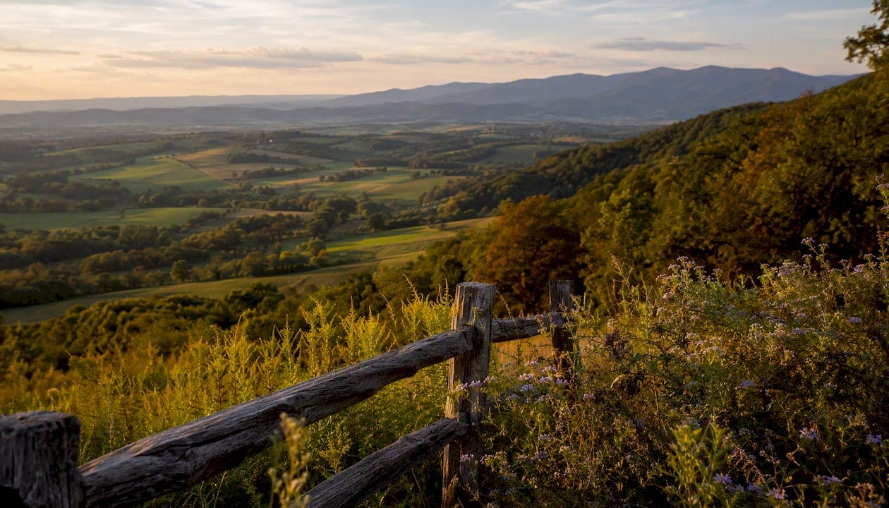
The Shenandoah Valley is a roughly 140–200 mile stretch of fertile lowland running southwest to northeast through western Virginia and into the Eastern Panhandle of West Virginia, flanked by the Blue Ridge Mountains to the east and the Ridge-and-Valley Appalachians to the west. Its central coordinates sit near 38.5°N, 78.7°W. The valley draws visitors for three reasons that rarely overlap this neatly in one region: world-class hiking along Shenandoah National Park's about 500 miles of trails, some of the most visited limestone caves in the eastern United States, and a Civil War history so dense that you can barely drive 20 miles without crossing a battlefield. The Shenandoah River, formed by its North Fork near Strasburg and South Fork near Waynesboro, gives the valley its name and its character.
Key Takeaways
The Shenandoah Valley rewards visitors who plan around its geography: the park and caverns anchor the experience, but the towns, river, and wineries are what turn a day trip into a week-long stay.
| Point | Details |
|---|---|
| Park scale | Shenandoah National Park covers ~200,000 acres with about 500 miles of trails for all fitness levels. |
| Top hikes | Stony Man suits beginners; Old Rag requires a timed-entry ticket and scrambling experience. |
| Best season | Spring (April–May) offers wildflowers and thin crowds; fall foliage peaks mid-October in the northern park. |
| Caves | Luray Caverns is the largest publicly accessible cavern in the eastern U.S., open year-round at a steady 54°F. |
| Living here | Winchester and Martinsburg serve as D.C. commuter bases; Staunton and Harrisonburg attract remote workers and retirees. |
Table of Contents
- What makes the Shenandoah Valley's geography so distinctive?
- A brief era-by-era history of the Shenandoah Valley
- Major towns and what each one offers visitors
- What should you know before visiting Shenandoah National Park?
- Caves and caverns worth visiting in the valley
- Outdoor activities and wine experiences across the valley
- How do you get to and around the Shenandoah Valley?
- Practical tips for planning your visit
- The valley's economy and cultural life
- Is the Shenandoah Valley a good place to live?
- What most visitors get wrong about the Shenandoah Valley
- Sources
What makes the Shenandoah Valley's geography so distinctive?
The valley sits inside the Ridge and Valley physiographic province, part of the larger Great Appalachian Valley system. Its eastern wall is the Blue Ridge; its western boundary is the Allegheny Front. The Potomac River marks the northern limit, where the Shenandoah joins it at Harpers Ferry, West Virginia. To the south, the valley grades into the upper James River drainage near Lexington, Virginia.
Massanutten Mountain, a 50-mile quartzite ridge, splits the central valley into two parallel troughs between Strasburg and Harrisonburg. The North Fork of the Shenandoah runs west of Massanutten; the South Fork runs east. This internal ridge is easy to miss on a map but shapes everything from hiking options to local weather patterns.
Principal Virginia counties in the valley include Shenandoah, Page, Rockingham, Augusta, Rockbridge, Frederick, Warren, and Clarke. On the West Virginia side, Berkeley and Morgan counties are typically included in the broader cultural definition.
Principal towns and cities:
- Winchester (northern anchor, Frederick County)
- Harrisonburg (central hub, Rockingham County)
- Staunton (southern cultural center, Augusta County)
- Lexington (southern gateway, Rockbridge County)
- Luray (Page County, caverns gateway)
- Waynesboro (southern entry to Skyline Drive)
- Martinsburg (West Virginia, Eastern Panhandle)
A brief era-by-era history of the Shenandoah Valley
Human presence in the valley stretches back thousands of years. Middle Woodland period peoples left burial mounds and settlement traces throughout the region, evidence that the valley's fertile floor and river access made it a natural corridor long before European contact. The Shenandoah name itself is widely attributed to Algonquian-speaking peoples, though its precise meaning is debated.
Colonial settlement accelerated after 1716, when Virginia Governor Alexander Spotswood led the Knights of the Golden Horseshoe expedition across the Blue Ridge. German and Scots-Irish settlers followed quickly, pushing down the valley from Pennsylvania. Adam Miller, among the earliest documented European settlers in the Shenandoah, established a presence near present-day Luray in the 1720s. By mid-century, the valley had become a productive agricultural corridor supplying grain and livestock to coastal markets.
During the Revolutionary War, the valley served as a manufacturing and logistics base. Iron furnaces and grist mills kept Continental Army supply lines running, and the region's distance from the coast made it relatively secure from British raids.
The Civil War transformed the valley's identity permanently. It became the Confederacy's "breadbasket," feeding Southern armies with grain and livestock that the Blue Ridge shielded from easy Union attack. Three major campaigns swept through: Stonewall Jackson's 1862 Valley Campaign, Jubal Early's 1864 operations, and Philip Sheridan's devastating response.
Sheridan's "Burning" of autumn 1864 destroyed barns, mills, and crops from Staunton to Strasburg, a scorched-earth campaign that left lasting marks on the region's economy and memory. Cedar Creek, Fisher's Hill, and New Market are among the battle sites still preserved and interpreted today.
The 20th century brought a different kind of transformation. Shenandoah National Park was established in 1935, and Skyline Drive, built partly by the Civilian Conservation Corps, opened the mountains to automobile tourism. That shift from agricultural isolation to a recreational destination defines the valley's modern identity.
Major towns and what each one offers visitors
The valley's towns are compact enough to visit several in a weekend, but each has a distinct personality.
-
Winchester is the valley's northern gateway and its most historically layered city. Stonewall Jackson's headquarters museum, the Museum of the Shenandoah Valley, and the Old Town pedestrian mall anchor a visit. The Shenandoah Apple Blossom Festival, held each May, draws crowds from across the mid-Atlantic.
-
Harrisonburg is the valley's largest city by population and its most college-influenced. James Madison University drives a lively food and arts scene. The Virginia Quilt Museum and Eastern Mennonite University's cultural programming add depth beyond the typical college-town offerings.
-
Staunton punches well above its size. The American Shakespeare Center performs year-round in the Blackfriars Playhouse, a faithful re-creation of Shakespeare's indoor theater. The Museum of the Shenandoah Valley, Woodrow Wilson's birthplace, and a walkable downtown of Victorian architecture make it a strong base for a two-night stay.
-
Lexington is home to Washington and Lee University and Virginia Military Institute, both of which maintain museums tied to Robert E. Lee and Stonewall Jackson. The Natural Bridge State Park, a 215-foot limestone arch, sits just south of town.
-
Luray is primarily a gateway to Luray Caverns and the South Fork of the Shenandoah River. Its small downtown has grown in recent years with breweries and outfitters catering to paddlers and hikers.
-
Martinsburg, WV offers Amtrak access on the MARC commuter line to Washington, D.C., making it a practical base for visitors arriving without a car. The Belle Boyd House and the B&O Railroad heritage sites reflect its Civil War and industrial past.
-
Waynesboro sits at the southern terminus of Skyline Drive and the northern end of the Blue Ridge Parkway, making it the logical staging point for anyone driving the full scenic corridor. The P. Buckley Moss Museum and a growing arts district give it more to offer than a simple pass-through stop.
What should you know before visiting Shenandoah National Park?
Shenandoah National Park covers approximately 200,000 acres along the Blue Ridge crest, with Skyline Drive running its full 105-mile length from Front Royal in the north to Rockfish Gap near Waynesboro in the south. Mile markers on Skyline Drive count from north to south, a detail that matters when you're navigating to a specific trailhead.
Vehicle entry passes are required; current fee information is listed on the NPS website and changes periodically, so check before you go. The America the Beautiful annual pass covers entry and pays for itself quickly if you visit multiple national parks.
Signature day hikes:
Old Rag deserves a separate note. It requires a timed-entry ticket purchased through Recreation.gov, and the rock scramble near the summit is genuinely technical. Fit hikers with scrambling experience find it rewarding; families with young children should choose Stony Man instead.
Visitor basics:
- Pets are allowed on most front-country trails but prohibited on some backcountry paths and in certain developed areas. Check the NPS pet policy page before bringing a dog.
- Backcountry camping requires a free permit, available at park visitor centers or self-registration stations.
- Cell service is limited or absent along most of Skyline Drive. Download offline maps before you arrive.
- Check the NPS alerts page for seasonal road closures, especially in winter when ice closes sections of Skyline Drive with little warning.
Pro Tip: Arrive at Stony Man or Hawksbill trailheads before 9 AM on fall weekends. Foliage season brings bumper-to-bumper traffic on Skyline Drive by mid-morning, and parking lots fill completely.
Caves and caverns worth visiting in the valley
The valley sits on a thick limestone belt, and karst geology has produced some of the most accessible showcaves on the East Coast.

Luray Caverns is the anchor attraction. It's the largest cavern system in the eastern United States open to the public, and its guided tours move through chambers with stalactites, stalagmites, and the Stalacpipe Organ, a musical instrument that uses rubber mallets to strike cave formations across 3.5 acres. The onsite Car & Carriage Museum and Shenandoah Heritage Village extend a visit well beyond the underground tour, which is useful when you're traveling with people who have different interests.
Other notable options:
- Shenandoah Caverns (near Quicksburg): the only Virginia cavern with elevator access, making it the most accessible choice for visitors with mobility limitations. The American Celebration on Parade exhibit adds a quirky cultural layer.
- Skyline Caverns (Front Royal): known for anthodite formations, rare spiky calcite crystals found in only a handful of caves worldwide. Compact tour, good for a shorter stop.
- Melrose Caverns (near Harrisonburg): smaller and less commercialized, with a more intimate tour experience.
All four operate year-round, since cave temperatures hold steady around 54°F regardless of season. That consistency makes caverns a smart backup plan when summer heat or a rainy fall day makes outdoor hiking less appealing.
Outdoor activities and wine experiences across the valley
The valley's recreational range is wider than most visitors expect before they arrive.
Hiking in Shenandoah National Park gets the most attention, but the George Washington and Jefferson National Forests, which border the park on the west, offer less-crowded trails with comparable scenery and no entry fee.
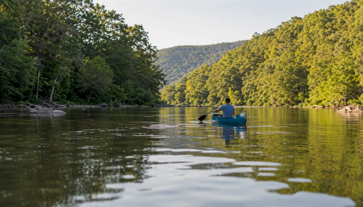
Paddling the Shenandoah River is one of the valley's underrated pleasures. The South Fork between Luray and Front Royal offers calm Class I–II water suitable for canoes and kayaks. Several outfitters in Luray and Bentonville rent equipment and run shuttle services, so you don't need to own gear.
Horseback riding is available through stables near Luray and along the park's fire roads, where horses are permitted on many trails.
Skiing and winter recreation center on Massanutten Resort near Harrisonburg, which offers downhill skiing, snowboarding, and tubing. Wintergreen Resort, just east of the valley on the Blue Ridge, is another option for winter visitors.
Wineries and the Blue Ridge Whisky Wine Loop: the valley and its surrounding foothills host dozens of wineries, cideries, and craft distilleries. The Blue Ridge Whisky Wine Loop connects producers across the northern valley and Loudoun County. Tasting rooms cluster around Luray, Front Royal, and the Shenandoah County wine country. Plan tastings with a designated driver or book a guided tour; the roads between producers are rural and two-lane.
Seasonal highlights:
- Spring (April–May): Wildflowers along Skyline Drive peak in late April. The Shenandoah Apple Blossom Festival in Winchester runs the first week of May.
- Summer (June–August): Best paddling conditions on the river; waterfalls are running well after spring rains.
- Fall (October–early November): Peak foliage typically hits the northern park in mid-October. Expect heavy traffic on Skyline Drive.
- Winter (December–March): Quiet trails, occasional snow on the ridge, and ski season at Massanutten.
Pro Tip: The Apple Blossom Festival and peak foliage weekends are the two most crowded periods in the valley. If you want the scenery without the traffic, visit the week before peak foliage color, when the drive is still beautiful and parking is available.
How do you get to and around the Shenandoah Valley?
The valley is well-positioned for road trips from the mid-Atlantic and Southeast, and rail access is better than most visitors realize.
-
By car via I-81: The primary north-south corridor runs the full length of the valley. From Washington, D.C., the drive to Front Royal takes roughly 75 minutes via I-66 West. Charlottesville to Staunton is about 35 minutes on I-64. Richmond to Staunton runs about 90 minutes via I-64.
-
By car via I-64 and I-66: These east-west interstates connect the valley to Richmond (I-64) and Northern Virginia (I-66), making it easy to enter from either end without driving the full length of I-81.
-
By Amtrak: The Cardinal and Crescent lines stop at Staunton, giving visitors from New York, Washington, and Chicago a car-free option for reaching the southern valley. Harpers Ferry and Martinsburg are served by Amtrak's Capitol Limited and by MARC commuter rail from Washington's Union Station, making the northern valley accessible without a car.
-
By air: Shenandoah Valley Regional Airport (SHD) near Weyers Cave serves the central valley with limited regional connections. Charlottesville Albemarle Airport (CHO) is 35 miles from Waynesboro. Washington Dulles (IAD) and Richmond International (RIC) are the major hubs, both roughly 90 minutes from the valley's center.
Parking on Skyline Drive is free at trailheads, but popular lots fill by mid-morning on weekends from May through November. Arriving before 8:30 AM or after 4 PM solves most parking problems.
Practical tips for planning your visit
Best seasons at a glance:
- Spring: Cooler temperatures, fewer crowds, and wildflowers make April and early May the most underrated time to visit.
- Summer: Hot in the valley floor (often 85–90°F), but the ridge runs 10–15°F cooler. Ideal for paddling and waterfall hikes.
- Fall: The most popular season. Foliage peaks mid-October in the north, late October in the south.
- Winter: Trails are quiet, and snow transforms the ridge into something genuinely beautiful. Some Skyline Drive sections close during ice events.
Safety and practical considerations:
- Carry at least two liters of water per person on any hike over three miles. Springs along backcountry trails require treatment.
- Wildlife is active throughout the park. Black bears are present; store food in bear canisters or hang it properly at backcountry sites.
- Cell service drops out along most of Skyline Drive. Download the NPS Shenandoah app and offline trail maps before you leave the car.
- Leave No Trace principles apply strictly. The park's trail conditions reflect it: stay on marked paths, pack out all trash.
Pet owners: Dogs are welcome on most Skyline Drive trails but must stay on a leash no longer than six feet. They are not permitted on the Old Rag trail or in park buildings. Check the current NPS pet policy before planning a dog-friendly hike.
Packing basics: Layers are non-negotiable on the ridge, even in July. Waterproof trail shoes outperform sneakers on wet rock. Bring a paper map as a backup; GPS signals can be unreliable in the hollows.
The valley's economy and cultural life
The Shenandoah Valley's economy runs on three pillars: manufacturing, logistics, and agriculture. According to the Virginia Economic Development Partnership, food and beverage manufacturing alone employs more than 5% of the regional labor force, with companies processing poultry, dairy, and grain products that trace directly to the valley's agricultural base. Distribution and logistics have grown alongside I-81's role as a major freight corridor.
Cultural life is richer than the valley's rural reputation suggests:
- The American Shakespeare Center in Staunton performs in the Blackfriars Playhouse with original staging practices, including audience members seated on stage. It's one of the few theaters in the world to re-create the Elizabethan indoor playhouse experience.
- The Museum of the Shenandoah Valley in Winchester combines fine and decorative arts with regional history in a purpose-built facility.
- New Market Battlefield State Historical Park interprets the May 1864 battle where VMI cadets fought, one of the Civil War's most unusual engagements.
- College-driven programming at James Madison University, Washington and Lee, and VMI brings music, theater, and lectures to the valley year-round.
The combination of living-history sites, performing arts, and seasonal festivals means a visitor can spend a week in the valley without repeating an experience type.
Is the Shenandoah Valley a good place to live?
For buyers and renters weighing a move, the valley offers a mix that's increasingly rare: small-city amenities, rural character, and reasonable proximity to Northern Virginia and Richmond job markets. Housing stock ranges from historic downtown properties in Staunton and Winchester to working farms in Page and Rockingham counties and newer suburban developments around Harrisonburg.
Commuting patterns matter here. Winchester and Martinsburg function as bedroom communities for Northern Virginia and D.C. workers who trade shorter commutes for lower housing costs. Staunton and Lexington attract retirees and remote workers drawn by culture and cost of living. Harrisonburg's university economy keeps the rental market active year-round.
Moving checklist for prospective residents:
- Research school districts by county; quality varies significantly across the valley.
- Confirm broadband availability before committing to a rural property. Fiber is available in towns; fixed wireless and satellite are common in hollows.
- Factor in commute time realistically. I-81 carries heavy truck traffic, and congestion near Harrisonburg and Winchester is real during peak hours.
- Review local tax rates; Virginia's property tax rates vary by jurisdiction, and some counties offer land-use tax deferrals for agricultural parcels.
- Check healthcare access. Augusta Health in Fishersville and Winchester Medical Center are the primary regional hospitals, with specialty care requiring travel to Charlottesville or Northern Virginia.
If you're considering buying or selling property in the valley, Beamsrealtygroup offers personalized guidance backed by deep local market knowledge across Virginia, from historic downtown properties to rural acreage.

What most visitors get wrong about the Shenandoah Valley
Most travel content treats the Shenandoah Valley as a Skyline Drive itinerary with a cave stop. That framing misses about half of what makes the region worth a serious visit.
The history here isn't decorative. The Civil War campaigns that swept through this valley, Jackson's 1862 run, Sheridan's 1864 Burning, weren't peripheral skirmishes. They shaped the outcome of the war and left a landscape still legible today: burned mill sites, preserved battlefields, and towns that rebuilt slowly and remember it. Visitors who skip the battlefield sites in favor of another winery are leaving the most distinctive part of the experience on the table.
The other underestimated element is the town culture. Staunton's American Shakespeare Center performs at a level that would draw audiences in any major city. Harrisonburg's food scene reflects a genuinely diverse community, shaped by Mennonite heritage and a large immigrant population that arrived through the poultry industry. These aren't consolation prizes for days when the weather is bad. They're reasons to stay longer.
On the practical side: the conventional advice to visit in fall for foliage is correct but incomplete. Peak foliage weekends on Skyline Drive are genuinely unpleasant if you're trying to hike. The drive is beautiful from a car window; the trailheads are parking-lot chaos. Spring, specifically the last two weeks of April, gives you wildflowers, empty trails, and the same mountain views without the traffic. That's the visit worth planning.
For anyone thinking about relocating, the valley's affordability relative to Northern Virginia is real, but the commute math deserves honesty. Winchester to D.C. is manageable; Harrisonburg to D.C. is a commitment. The valley works best as a home base when your job is local or fully remote.
Sources
These are the primary sources worth bookmarking before you visit or move to the valley:
- Shenandoah National Park (U.S. National Park Service)
- Shenandoah Valley | Virginia Economic Development Partnership
- Luray Caverns - What will you discover?
- Shenandoah Valley - Virginia Is For Lovers